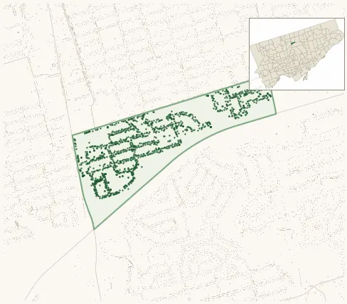
Neighbourhood · #153
Avondale
1,470 street trees · 0.26 km² · pop. 13,790
What the numbers say
Avondale is above-average for tree density (60th of 158), with 1,470 city-owned street trees across 0.26 km² — 5,556 per km².
Tree canopy covers 27.8% of the neighbourhood (66th of 158) — essentially unchanged since 2008. (This includes all trees — street, park, and private — from the 2018 land-cover raster.)
Across 127 distinct species (Shannon diversity 3.99, 107th of 158), the most common is acer platanoides at 8.8% of the trees.
Most common species here
| Species | Trees | Share |
|---|---|---|
| Norway Maple acer platanoides | 130 | 8.8% |
| Silver Maple acer saccharinum | 94 | 6.4% |
| Honey Locust gleditsia triacanthos | 67 | 4.6% |
| Sargents Apple malus sargentii | 53 | 3.6% |
| Red Oak quercus rubra | 52 | 3.5% |
The biggest tree on record
A Silver Maple (acer saccharinum) at 37 GLENDORA AVE — 168 cm DBH, the largest of the 1,470 street trees here. · Street View
Explore
Tree counts and species from the City of Toronto Street Tree dataset (city-owned trees in the road allowance only — not parks or private property). Canopy % and heat proxy derive from the 2018 land-cover raster. Population is from the 2021 census, joined by the 158-neighbourhood model.