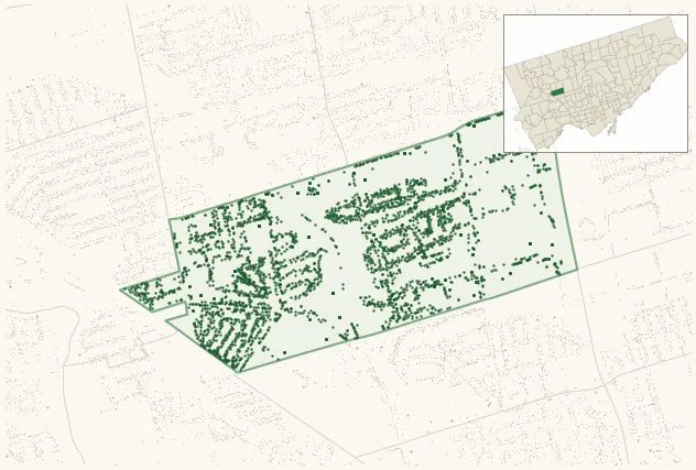
Neighbourhood · #030
Brookhaven-Amesbury
4,081 street trees · 0.89 km² · pop. 17,495
What the numbers say
Brookhaven-Amesbury is middle-of-the-pack for street trees (91st of 158), with 4,081 city-owned street trees across 0.89 km² — 4,578 per km².
Tree canopy covers 19.8% of the neighbourhood (106th of 158) — down 2.7 points since 2008. (This includes all trees — street, park, and private — from the 2018 land-cover raster.)
Across 169 distinct species (Shannon diversity 4.25, 25th of 158), the most common is acer platanoides at 9.0% of the trees.
Most common species here
| Species | Trees | Share |
|---|---|---|
| Norway Maple acer platanoides | 366 | 9.0% |
| Littleleaf Linden tilia cordata | 220 | 5.4% |
| Colorado Blue Spruce picea pungens | 193 | 4.7% |
| Honey Locust gleditsia triacanthos | 132 | 3.2% |
| White Spruce picea glauca | 107 | 2.6% |
The biggest tree on record
A Northern Catalpa (catalpa speciosa) at 35 HEARST CRCL — 175 cm DBH, the largest of the 4,081 street trees here. · Street View
Explore
Tree counts and species from the City of Toronto Street Tree dataset (city-owned trees in the road allowance only — not parks or private property). Canopy % and heat proxy derive from the 2018 land-cover raster. Population is from the 2021 census, joined by the 158-neighbourhood model.