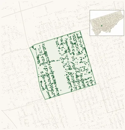
Neighbourhood · #109
Caledonia-Fairbank
2,027 street trees · 0.39 km² · pop. 10,015
What the numbers say
Caledonia-Fairbank is middle-of-the-pack for street trees (74th of 158), with 2,027 city-owned street trees across 0.39 km² — 5,149 per km².
Tree canopy covers 22.3% of the neighbourhood (94th of 158) — essentially unchanged since 2008. (This includes all trees — street, park, and private — from the 2018 land-cover raster.)
Across 156 distinct species (Shannon diversity 4.29, 14th of 158), the most common is acer platanoides at 4.8% of the trees.
Most common species here
| Species | Trees | Share |
|---|---|---|
| Norway Maple acer platanoides | 97 | 4.8% |
| Manitoba Maple acer negundo | 86 | 4.2% |
| Colorado Blue Spruce picea pungens | 82 | 4.0% |
| Siberian Elm ulmus pumila | 77 | 3.8% |
| Spruce picea | 69 | 3.4% |
The biggest tree on record
A Silver Maple (acer saccharinum) at 54 SUMMIT AVE — 135 cm DBH, the largest of the 2,027 street trees here. · Street View
Explore
Tree counts and species from the City of Toronto Street Tree dataset (city-owned trees in the road allowance only — not parks or private property). Canopy % and heat proxy derive from the 2018 land-cover raster. Population is from the 2021 census, joined by the 158-neighbourhood model.