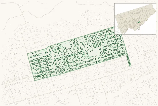
Neighbourhood · #059
Danforth East York
3,341 street trees · 0.56 km² · pop. 17,065
What the numbers say
Danforth East York is above-average for tree density (52nd of 158), with 3,341 city-owned street trees across 0.56 km² — 5,921 per km².
Tree canopy covers 19.7% of the neighbourhood (107th of 158) — essentially unchanged since 2008. (This includes all trees — street, park, and private — from the 2018 land-cover raster.)
Across 181 distinct species (Shannon diversity 4.35, 3rd of 158), the most common is acer platanoides at 7.5% of the trees.
Most common species here
| Species | Trees | Share |
|---|---|---|
| Norway Maple acer platanoides | 252 | 7.5% |
| Red Oak quercus rubra | 133 | 4.0% |
| Serviceberry amelanchier canadensis | 118 | 3.5% |
| Silver Maple acer saccharinum | 117 | 3.5% |
| Colorado Blue Spruce picea pungens | 108 | 3.2% |
The biggest tree on record
A Silver Maple (acer saccharinum) at 809 COXWELL AVE — 150 cm DBH, the largest of the 3,341 street trees here. · Street View
Explore
Tree counts and species from the City of Toronto Street Tree dataset (city-owned trees in the road allowance only — not parks or private property). Canopy % and heat proxy derive from the 2018 land-cover raster. Population is from the 2021 census, joined by the 158-neighbourhood model.