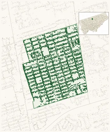
Neighbourhood · #152
East Willowdale
7,071 street trees · 0.90 km² · pop. 15,485
What the numbers say
East Willowdale is one of the most tree-dense neighbourhoods in Toronto — 13th of 158, with 7,071 city-owned street trees across 0.90 km² — 7,845 per km².
Tree canopy covers 31.6% of the neighbourhood (51st of 158) — essentially unchanged since 2008. (This includes all trees — street, park, and private — from the 2018 land-cover raster.)
Across 177 distinct species (Shannon diversity 3.97, 114th of 158), the most common is acer platanoides at 9.4% of the trees.
Most common species here
| Species | Trees | Share |
|---|---|---|
| Norway Maple acer platanoides | 667 | 9.4% |
| Silver Maple acer saccharinum | 603 | 8.5% |
| Colorado Blue Spruce picea pungens | 416 | 5.9% |
| White Spruce picea glauca | 335 | 4.7% |
| Honey Locust Shademaster gleditsia triacanthos f. inermis 'shademaster' | 290 | 4.1% |
The biggest tree on record
A Plum (prunus spp.) at 463 KENNETH AVE NORTH YORK — 200 cm DBH, the largest of the 7,071 street trees here. · Street View
Explore
Tree counts and species from the City of Toronto Street Tree dataset (city-owned trees in the road allowance only — not parks or private property). Canopy % and heat proxy derive from the 2018 land-cover raster. Population is from the 2021 census, joined by the 158-neighbourhood model.