Neighbourhood · #025
Glenfield-Jane Heights
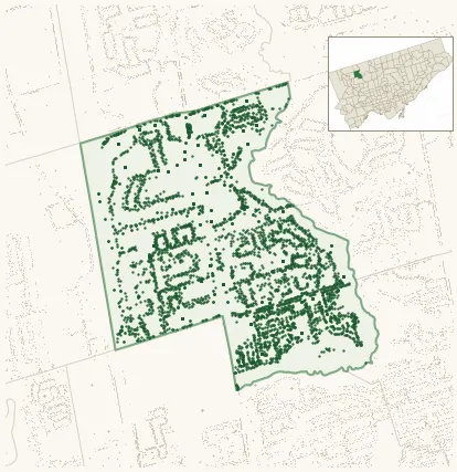
Neighbourhood Improvement Area 4,819 street trees · 1.31 km² · pop. 30,020
What the numbers say
Glenfield-Jane Heights is middle-of-the-pack for street trees (114th of 158), with 4,819 city-owned street trees across 1.31 km² — 3,688 per km².
Tree canopy covers 17.0% of the neighbourhood (121st of 158) — down 2.5 points since 2008. (This includes all trees — street, park, and private — from the 2018 land-cover raster.)
Across 162 distinct species (Shannon diversity 4.19, 48th of 158), the most common is acer platanoides at 8.2% of the trees.
Most common species here
| Species | Trees | Share |
|---|---|---|
| Norway Maple acer platanoides | 393 | 8.2% |
| Kentucky Coffeetree gymnocladus dioicus | 219 | 4.5% |
| Ginkgo ginkgo biloba | 213 | 4.4% |
| Japanese Lilac syringa reticulata | 207 | 4.3% |
| Littleleaf Linden tilia cordata | 170 | 3.5% |
The biggest tree on record
A Golden Weeping Willow (salix x sepulcralis 'chrysocoma') at 101 OAKDALE RD — 142 cm DBH, the largest of the 4,819 street trees here. · Street View
Explore
Tree counts and species from the City of Toronto Street Tree dataset (city-owned trees in the road allowance only — not parks or private property). Canopy % and heat proxy derive from the 2018 land-cover raster. Population is from the 2021 census, joined by the 158-neighbourhood model.