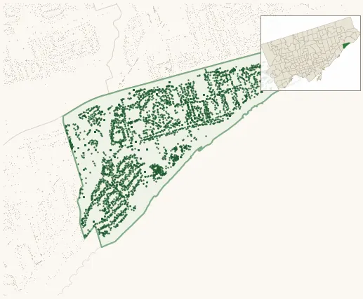
Neighbourhood · #140
Guildwood
4,372 street trees · 0.99 km² · pop. 9,680
What the numbers say
Guildwood is middle-of-the-pack for street trees (98th of 158), with 4,372 city-owned street trees across 0.99 km² — 4,396 per km².
Tree canopy covers 43.2% of the neighbourhood (12th of 158) — down 2.6 points since 2008. (This includes all trees — street, park, and private — from the 2018 land-cover raster.) Heat-risk proxy ranks it 10th-coolest in the city.
Across 171 distinct species (Shannon diversity 4.18, 50th of 158), the most common is fraxinus pennsylvanica at 8.1% of the trees.
Most common species here
| Species | Trees | Share |
|---|---|---|
| Green Ash fraxinus pennsylvanica | 355 | 8.1% |
| Norway Maple acer platanoides | 298 | 6.8% |
| Littleleaf Linden tilia cordata | 243 | 5.6% |
| Sargents Apple malus sargentii | 165 | 3.8% |
| Red Oak quercus rubra | 155 | 3.5% |
The biggest tree on record
A Silver Maple (acer saccharinum) at 32 DEARHAM WOOD — 200 cm DBH, the largest of the 4,372 street trees here. · Street View
Explore
Tree counts and species from the City of Toronto Street Tree dataset (city-owned trees in the road allowance only — not parks or private property). Canopy % and heat proxy derive from the 2018 land-cover raster. Population is from the 2021 census, joined by the 158-neighbourhood model.