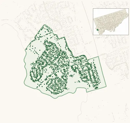
Neighbourhood · #012
Markland Wood
3,902 street trees · 0.74 km² · pop. 10,365
What the numbers say
Markland Wood is middle-of-the-pack for street trees (68th of 158), with 3,902 city-owned street trees across 0.74 km² — 5,246 per km².
Tree canopy covers 32.2% of the neighbourhood (48th of 158) — essentially unchanged since 2008. (This includes all trees — street, park, and private — from the 2018 land-cover raster.)
Across 174 distinct species (Shannon diversity 4.09, 83rd of 158), the most common is acer platanoides at 12.1% of the trees.
Most common species here
| Species | Trees | Share |
|---|---|---|
| Norway Maple acer platanoides | 473 | 12.1% |
| Sargents Apple malus sargentii | 213 | 5.5% |
| Honey Locust gleditsia triacanthos | 193 | 4.9% |
| Linden tilia | 191 | 4.9% |
| Colorado Blue Spruce picea pungens | 162 | 4.2% |
The biggest tree on record
A Silver Maple (acer saccharinum) at 42 BEARBURY DR — 160 cm DBH, the largest of the 3,902 street trees here. · Street View
Explore
Tree counts and species from the City of Toronto Street Tree dataset (city-owned trees in the road allowance only — not parks or private property). Canopy % and heat proxy derive from the 2018 land-cover raster. Population is from the 2021 census, joined by the 158-neighbourhood model.