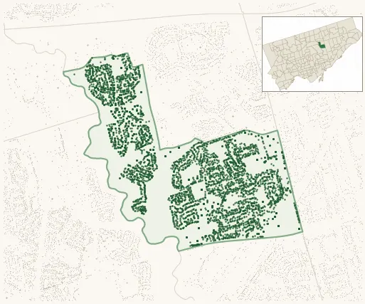
Neighbourhood · #149
Parkwoods-O'Connor Hills
6,183 street trees · 1.07 km² · pop. 13,965
What the numbers say
Parkwoods-O'Connor Hills is above-average for tree density (57th of 158), with 6,183 city-owned street trees across 1.07 km² — 5,777 per km².
Tree canopy covers 36.5% of the neighbourhood (30th of 158) — essentially unchanged since 2008. (This includes all trees — street, park, and private — from the 2018 land-cover raster.)
Across 168 distinct species (Shannon diversity 3.89, 126th of 158), the most common is acer platanoides at 16.1% of the trees.
Most common species here
| Species | Trees | Share |
|---|---|---|
| Norway Maple acer platanoides | 997 | 16.1% |
| Colorado Blue Spruce picea pungens | 489 | 7.9% |
| White Birch betula papyrifera | 359 | 5.8% |
| Sargents Apple malus sargentii | 278 | 4.5% |
| Austrian Pine pinus nigra | 266 | 4.3% |
The biggest tree on record
A Silver Maple (acer saccharinum) at 75 BROOKBANKS DR — 152 cm DBH, the largest of the 6,183 street trees here. · Street View
Explore
Tree counts and species from the City of Toronto Street Tree dataset (city-owned trees in the road allowance only — not parks or private property). Canopy % and heat proxy derive from the 2018 land-cover raster. Population is from the 2021 census, joined by the 158-neighbourhood model.