Neighbourhood · #139
Scarborough Village
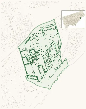
Neighbourhood Improvement Area 2,108 street trees · 0.82 km² · pop. 16,520
What the numbers say
Scarborough Village is among the least-forested in the city (142nd of 158), with 2,108 city-owned street trees across 0.82 km² — 2,565 per km².
Tree canopy covers 38.4% of the neighbourhood (22nd of 158) — down 15.8 points since 2008. (This includes all trees — street, park, and private — from the 2018 land-cover raster.) Heat-risk proxy ranks it 22nd-coolest in the city.
Across 142 distinct species (Shannon diversity 4.14, 66th of 158), the most common is acer platanoides at 11.2% of the trees.
Most common species here
| Species | Trees | Share |
|---|---|---|
| Norway Maple acer platanoides | 237 | 11.2% |
| Silver Maple acer saccharinum | 136 | 6.5% |
| Red Oak quercus rubra | 80 | 3.8% |
| Kentucky Coffeetree gymnocladus dioicus | 69 | 3.3% |
| Honey Locust gleditsia triacanthos | 62 | 2.9% |
The biggest tree on record
A Carolina Poplar (populus x canadensis (populus nigra x deltoides)) at 37 MUIR DR — 168 cm DBH, the largest of the 2,108 street trees here. · Street View
Explore
Tree counts and species from the City of Toronto Street Tree dataset (city-owned trees in the road allowance only — not parks or private property). Canopy % and heat proxy derive from the 2018 land-cover raster. Population is from the 2021 census, joined by the 158-neighbourhood model.