Neighbourhood · #166
St Lawrence-East Bayfront-The Islands
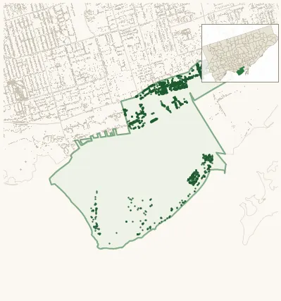
2,815 street trees · 2.90 km² · pop. 31,285
What the numbers say
St Lawrence-East Bayfront-The Islands is among the least-forested in the city (158th of 158), with 2,815 city-owned street trees across 2.90 km² — 970 per km².
Tree canopy covers 14.0% of the neighbourhood (137th of 158) — essentially unchanged since 2008. (This includes all trees — street, park, and private — from the 2018 land-cover raster.)
Across 116 distinct species (Shannon diversity 3.57, 150th of 158), the most common is gleditsia triacanthos at 12.0% of the trees.
Most common species here
| Species | Trees | Share |
|---|---|---|
| Honey Locust gleditsia triacanthos | 337 | 12.0% |
| Elm ulmus | 335 | 11.9% |
| Green Ash fraxinus pennsylvanica | 231 | 8.2% |
| Red Oak quercus rubra | 192 | 6.8% |
| Norway Maple acer platanoides | 125 | 4.4% |
The biggest tree on record
A Willow (salix) at 1 CENTRE ISLAND PK — 150 cm DBH, the largest of the 2,815 street trees here. · Street View
Explore
Tree counts and species from the City of Toronto Street Tree dataset (city-owned trees in the road allowance only — not parks or private property). Canopy % and heat proxy derive from the 2018 land-cover raster. Population is from the 2021 census, joined by the 158-neighbourhood model.