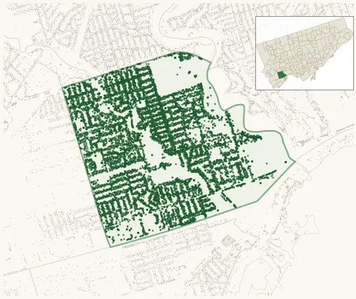
Neighbourhood · #016
Stonegate-Queensway
12,556 street trees · 2.01 km² · pop. 25,650
What the numbers say
Stonegate-Queensway is above-average for tree density (39th of 158), with 12,556 city-owned street trees across 2.01 km² — 6,232 per km².
Tree canopy covers 34.0% of the neighbourhood (40th of 158) — essentially unchanged since 2008. (This includes all trees — street, park, and private — from the 2018 land-cover raster.)
Across 210 distinct species (Shannon diversity 4.28, 20th of 158), the most common is acer platanoides at 12.1% of the trees.
Most common species here
| Species | Trees | Share |
|---|---|---|
| Norway Maple acer platanoides | 1,523 | 12.1% |
| Colorado Blue Spruce picea pungens | 694 | 5.5% |
| Japanese Lilac syringa reticulata | 420 | 3.3% |
| Honey Locust gleditsia triacanthos | 369 | 2.9% |
| Red Oak quercus rubra | 360 | 2.9% |
The biggest tree on record
A Tree Of Heaven (allianthus altissima) at 278 PRINCE EDWARD DR S — 200 cm DBH, the largest of the 12,556 street trees here. · Street View
Explore
Tree counts and species from the City of Toronto Street Tree dataset (city-owned trees in the road allowance only — not parks or private property). Canopy % and heat proxy derive from the 2018 land-cover raster. Population is from the 2021 census, joined by the 158-neighbourhood model.