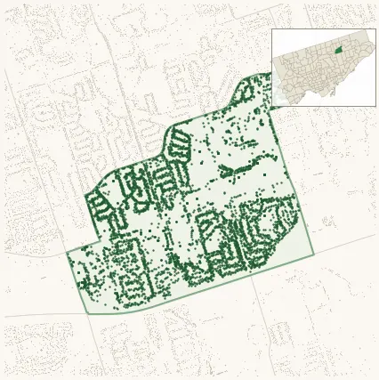
Neighbourhood · #118
Tam O'Shanter-Sullivan
5,721 street trees · 1.40 km² · pop. 27,205
What the numbers say
Tam O'Shanter-Sullivan is middle-of-the-pack for street trees (105th of 158), with 5,721 city-owned street trees across 1.40 km² — 4,076 per km².
Tree canopy covers 23.9% of the neighbourhood (84th of 158) — essentially unchanged since 2008. (This includes all trees — street, park, and private — from the 2018 land-cover raster.)
Across 166 distinct species (Shannon diversity 3.94, 117th of 158), the most common is acer platanoides at 15.4% of the trees.
Most common species here
| Species | Trees | Share |
|---|---|---|
| Norway Maple acer platanoides | 879 | 15.4% |
| Littleleaf Linden tilia cordata | 549 | 9.6% |
| Sargents Apple malus sargentii | 217 | 3.8% |
| Red Oak quercus rubra | 195 | 3.4% |
| Japanese Lilac syringa reticulata | 189 | 3.3% |
The biggest tree on record
A Silver Maple (acer saccharinum) at 122 ALLANFORD RD — 125 cm DBH, the largest of the 5,721 street trees here. · Street View
Explore
Tree counts and species from the City of Toronto Street Tree dataset (city-owned trees in the road allowance only — not parks or private property). Canopy % and heat proxy derive from the 2018 land-cover raster. Population is from the 2021 census, joined by the 158-neighbourhood model.