Neighbourhood · #136
West Hill
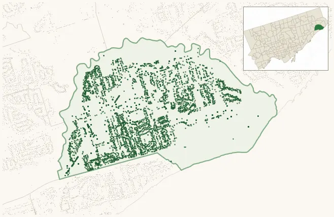
Neighbourhood Improvement Area 5,623 street trees · 2.52 km² · pop. 28,140
What the numbers say
West Hill is among the least-forested in the city (151st of 158), with 5,623 city-owned street trees across 2.52 km² — 2,231 per km².
Tree canopy covers 37.4% of the neighbourhood (27th of 158) — down 3.3 points since 2008. (This includes all trees — street, park, and private — from the 2018 land-cover raster.)
Across 167 distinct species (Shannon diversity 4.24, 28th of 158), the most common is acer platanoides at 8.2% of the trees.
Most common species here
| Species | Trees | Share |
|---|---|---|
| Norway Maple acer platanoides | 461 | 8.2% |
| Silver Maple acer saccharinum | 240 | 4.3% |
| Sargents Apple malus sargentii | 217 | 3.9% |
| Japanese Lilac syringa reticulata | 214 | 3.8% |
| Red Oak quercus rubra | 193 | 3.4% |
The biggest tree on record
A Silver Maple (acer saccharinum) at 2 APSCO AVE — 190 cm DBH, the largest of the 5,623 street trees here. · Street View
Explore
Tree counts and species from the City of Toronto Street Tree dataset (city-owned trees in the road allowance only — not parks or private property). Canopy % and heat proxy derive from the 2018 land-cover raster. Population is from the 2021 census, joined by the 158-neighbourhood model.