Neighbourhood · #037
Willowdale West
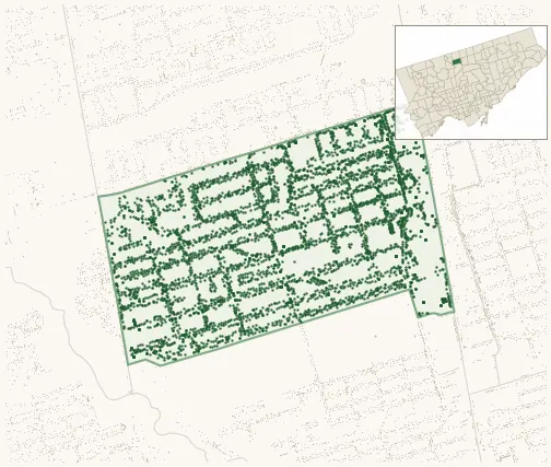
5,411 street trees · 0.74 km² · pop. 17,160
What the numbers say
Willowdale West is one of the most tree-dense neighbourhoods in Toronto — 19th of 158, with 5,411 city-owned street trees across 0.74 km² — 7,334 per km².
Tree canopy covers 29.5% of the neighbourhood (62nd of 158) — up 1.8 points since 2008. (This includes all trees — street, park, and private — from the 2018 land-cover raster.)
Across 165 distinct species (Shannon diversity 4.11, 71st of 158), the most common is acer platanoides at 7.1% of the trees.
Most common species here
| Species | Trees | Share |
|---|---|---|
| Norway Maple acer platanoides | 385 | 7.1% |
| Honey Locust gleditsia triacanthos | 297 | 5.5% |
| Colorado Blue Spruce picea pungens | 288 | 5.3% |
| Sargents Apple malus sargentii | 260 | 4.8% |
| Japanese Lilac syringa reticulata | 206 | 3.8% |
The biggest tree on record
A American Elm (ulmus americana) at 302 BETTY ANN DR — 136 cm DBH, the largest of the 5,411 street trees here. · Street View
Explore
Tree counts and species from the City of Toronto Street Tree dataset (city-owned trees in the road allowance only — not parks or private property). Canopy % and heat proxy derive from the 2018 land-cover raster. Population is from the 2021 census, joined by the 158-neighbourhood model.